Object assessment by short range flights
|
Assessment of facilities difficult to access or those in dangerous environments for humans using unmanned aerial vehicles – in comparison to conventional methods – offers a quick and cost-efficient solution. By the subsequent processing of the data of the various sensors – optical or other – or their real time display, the users can obtain a clear picture of the status of the land under assessment. Possible fields of application:
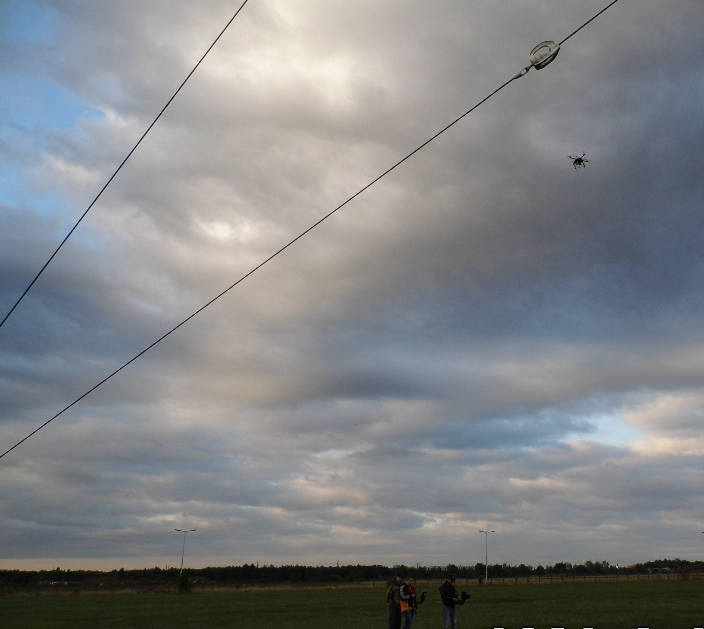
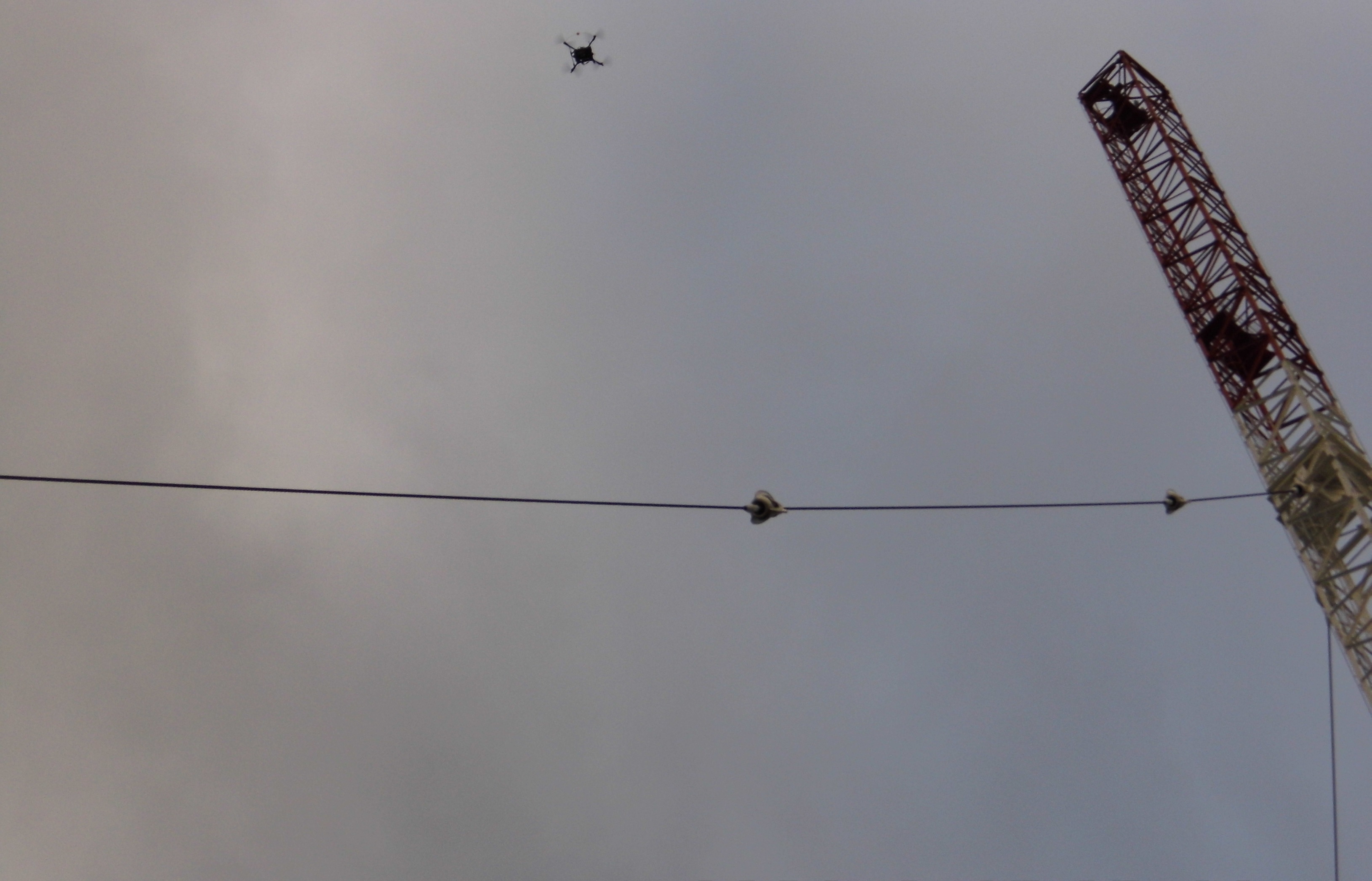
In this field, we perform antenna assessments for Hungary’s leading telecommunications service provider, during which we detected defects of insulation rings installed at heights. In comparison to the practice adopted in the past – using alpine technology – rotary wing unmanned aerial vehicles are now deployed to carry out the task with the regular operation of the control tower, in a fast, and last but not least, cost-efficient manner. |
|
|
Area measurements |
|
|
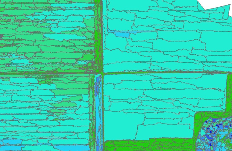
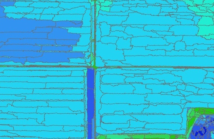
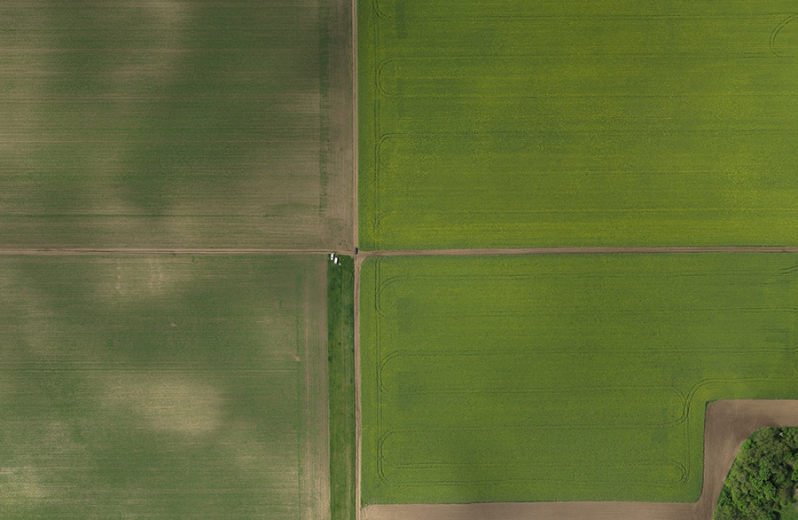
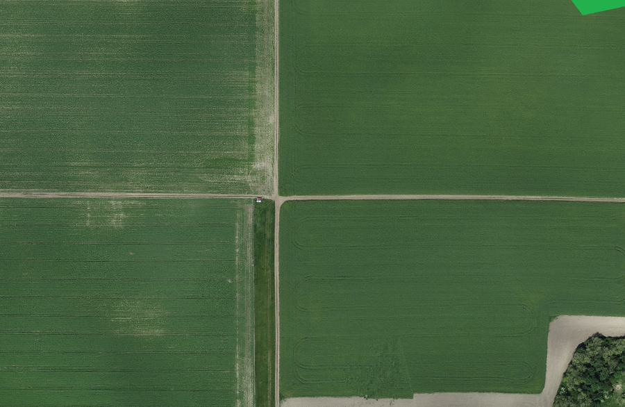
By using the data of optical sensors placed onboard autonomous rigid wing aircraft – multispectral, RGB, NIR, IR cameras or other sensors – the remote sensing of large areas can be implemented. The real time information available during the mission allows quick and efficient decision making assistance, while the data collected and stored from the area make more complex analyses possible later on. Possible fields of application:
|
|
|
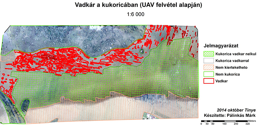
Assessment of game damage and damage caused by inland water |
|
|
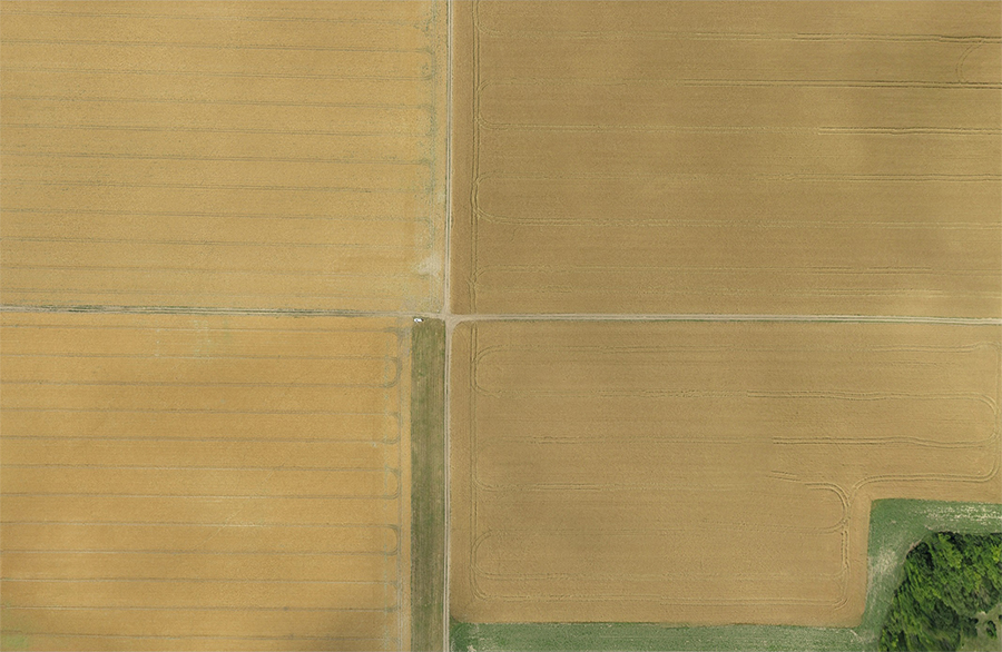
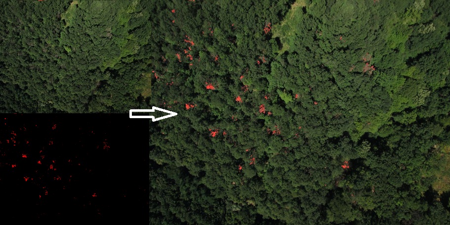
As an additional possibility of area assessment application, we conducted investigations over areas affected by game damage and inland water. The aim of the test was to provide farmers with data and information, based on which they can precisely establish the extent of any damage suffered and the size of the area affected. |
|


|
Agricultural ICT research and development, agricultural application |
||
|
Measurement data collecting systems, sensors and intelligent decision-assisting systems able to process the collected data, which are already in use in many IT fields, are becoming increasingly common in agriculture as well. Today, automatic fleet management of machinery, such as digital follow-up of working hours and forwarding messages to smartphones upon error codes or other preset statuses is no longer unimaginable. In this IT and technological leap forward, the share of UAV may be increasingly larger. By using the system - considered a quick, efficient and cheap solution - producers may acquire information that they have previously tried to obtain from satellite images or aerial photographs taken from small aircraft. |
|
|